Press kit
Space Radar
A live 3D map of space in a browser: satellites and the space station, launches, probes, planets, stars and galaxies, each drawn where it really is, with where the numbers come from.
spaceradar.ai · free, no account
Boilerplate
To copy as it is. The sixty-word version:
Space Radar (spaceradar.ai) is a free, open-source 3D map of space that runs in a browser. It shows the satellites around the Earth, the planets and their moons, 109 389 stars and 28 narrated trips, and labels every picture as measured, modelled or an artist's impression. It has no accounts, advertising or tracking, and works fully offline in a classroom.
The one-line version, for a caption or a list:
Space Radar is a free, open-source 3D map of space in your browser: real positions, named sources, no account, and an offline copy for classrooms.
Space Radar (spaceradar.ai) is not affiliated with the Korean company SpaceRadar or with any other product or page that has the same or a similar name.
What it is
Space Radar is a web page. It reads public catalogues (orbital elements, ephemerides, launch schedules, space weather) and works out, in the visitor's own browser, where each thing is this second. A visitor can search for an object, follow it, read a short card about it, see when it passes over them, or take a guided trip that flies the camera from stop to stop.
It is built to be honest about what it shows. Every drawn thing is measured, modelled or illustrative, and says which; every number names its source and how old it is.
Five facts
- Every position is computed in the visitor's browser from public data, for the instant on the clock: satellites from their orbital elements, planets and probes from ephemerides. The clock can be moved, and the sky moves with it.
- It draws 29 layers, from the space station and the satellites around the Earth to the planets, the nearby stars and the galaxies, and reads 31 feeds from 14 public sources to do it.
- There are 28 guided trips: the camera flies from stop to stop, with a short text at each, and a visitor can leave at any moment and keep exploring from there.
- Each card says how its numbers were obtained and how old the input is; a sources sheet lists every source with its age. Nothing computed is presented as measured.
- It is a static web page with no account, no advertising and no tracker, and the code is open source.
Facts at a glance
Counted from the project's registries on the day this page is built, not typed.
| Guided trips | 28 trips, 215 stops, read aloud |
|---|---|
| Stars placed in 3D | 109 389 |
| Star systems to fly into | 40 |
| Moons, with real maps | 21 (20) |
| Landing sites | 20 on the Moon, 12 on Mars |
| Layers in What to show | 29 |
| Public data sources | 14 publishers, 31 feeds read from them |
| Real spacecraft models | 126 |
| Licence | MIT (code); data and pictures keep their owners' licences |
Where to find us
| @spaceradar.ai | |
| SpaceRadar.ai | |
| YouTube | @SpaceRadar_ai |
| GitHub | Sara-Managed-Projects/space-radar |
Pictures
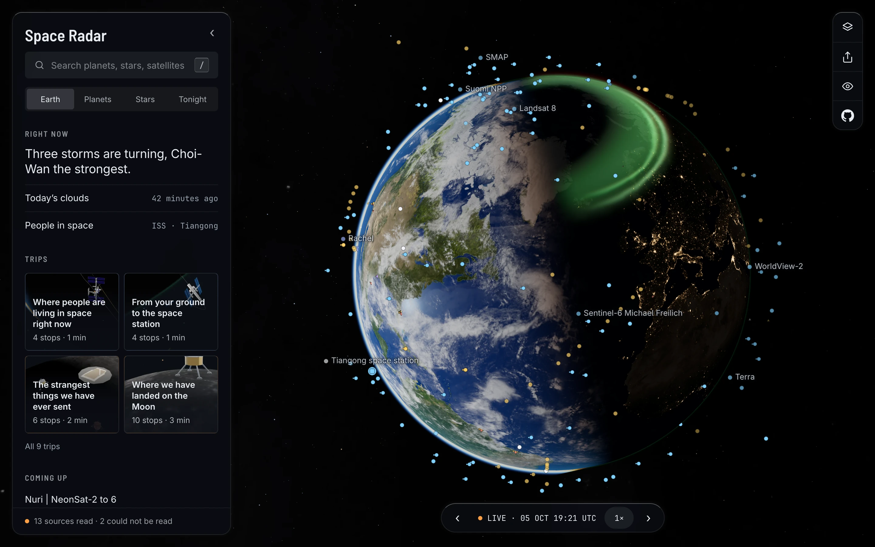
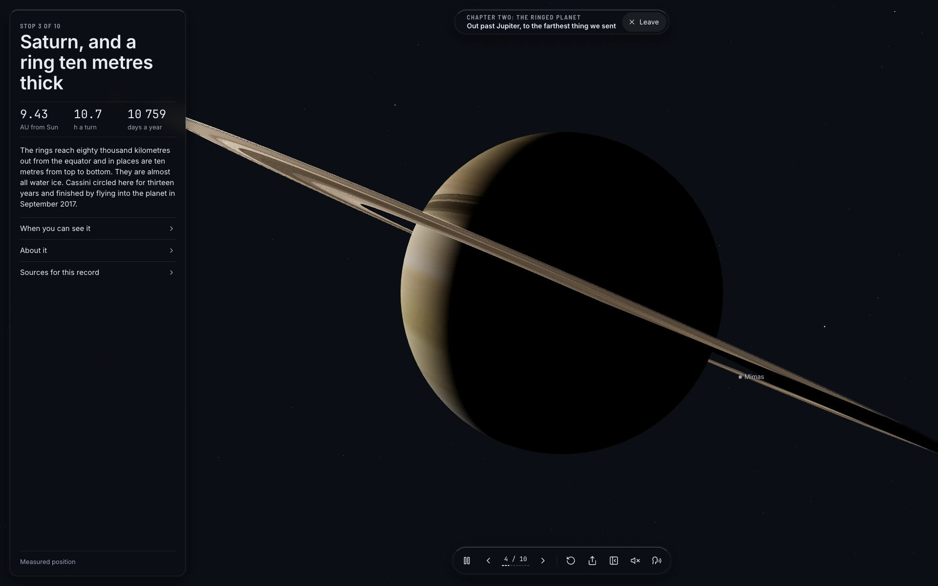
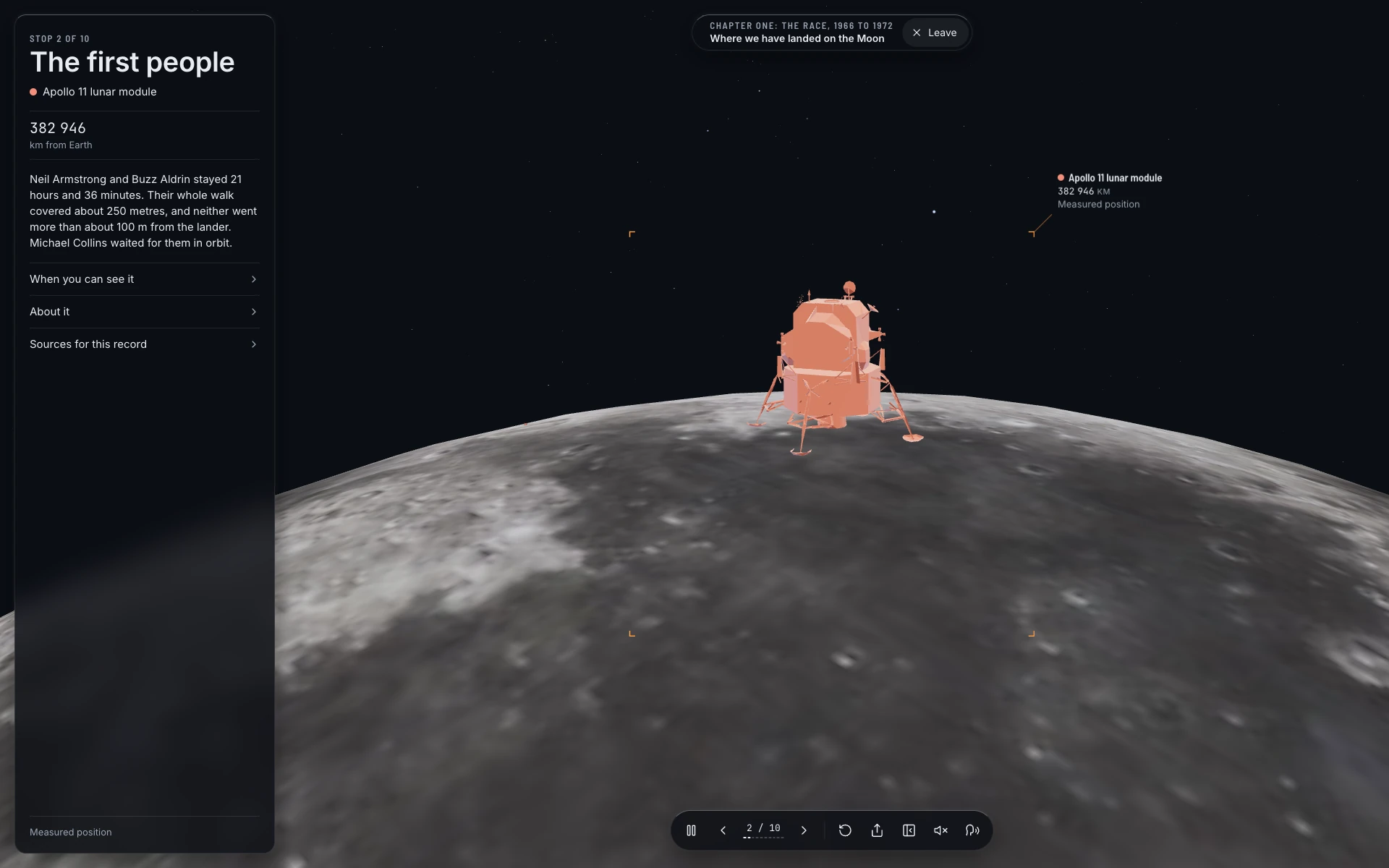
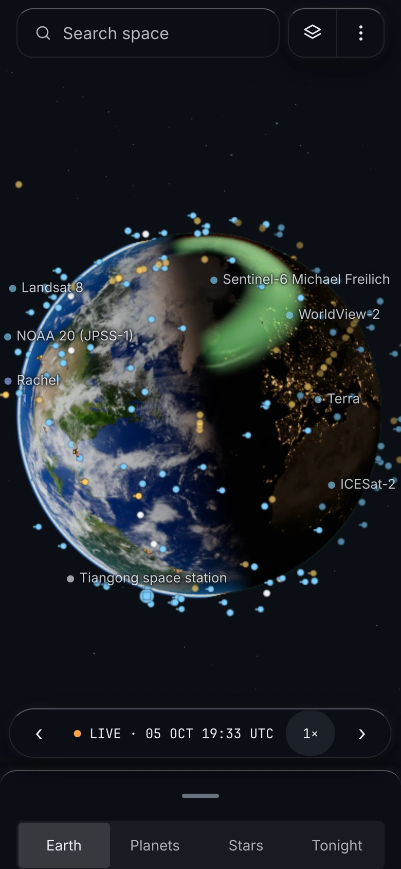
Screenshots of the app and the repository's social preview, free to use in coverage of Space Radar with the credit "Space Radar (spaceradar.ai)". They are drawings from measured positions, not photographs: please caption them as such. Planet and Earth textures in them are from the sources listed in the credits.

Mark and wordmark
SVG, for use when writing about the project. Please do not redraw or recolour them.



How to cite it
Space Radar contributors. Space Radar: a live 3D map of space in the browser. https://www.spaceradar.ai (MIT licence). Source code: github.com/Sara-Managed-Projects/space-radar. A machine-readable citation is in CITATION.cff, which GitHub turns into a "Cite this repository" button. Please add the date you looked, and cite the data's own publishers for any number you quote from a card.
Embed one live object
A story can carry one live object in a frame: the scene, the object's tag and a link back. The embedding guide has the snippet and the parameters; in the app it is Share, then Embed.
Licence and credits
The code is open source under the MIT License. Textures, 3D models, sounds, fonts and data keep their own licences, each listed with its source in CREDITS.md.
Contact
Questions, corrections and press requests go through the project's GitHub: open an issue or start a discussion. A correction to a fact on a card is always welcome there.