What is new in 1.2.0
The Moon at a low Sun, the giants' rings and the plumes
Release 1.2.0 went back to the nearest worlds and drew them more honestly: real shadows, rings as dark as they are, and plumes only where a spacecraft saw them.
Release 1.2.0 · 27 October 2026 · about 4 minutes
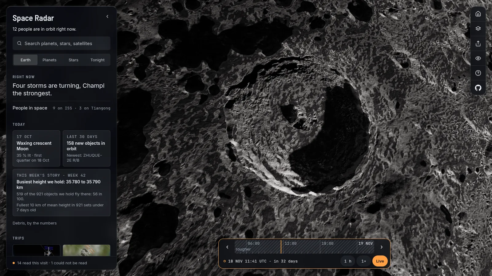
The Solar System was the first thing Space Radar drew, and release 1.2.0 went back to it with one question: what would an honest picture of these places show that ours did not? The answer was shadows, rings that are as dark as they really are, and plumes drawn only where a spacecraft saw them.
The Moon, at a low Sun
The Moon looks flat at noon and wild near the terminator, where the Sun is low and every rim throws a long shadow. The map now draws those shadows. They are cast by the Moon's own heights, from LOLA, the laser altimeter on the Lunar Reconnaissance Orbiter, one height every 670 metres at best, at the true scale of the ground. That is also the limit: a crater under about two kilometres casts no shadow, and the card says so.
Fly low over a crater such as Tycho or Copernicus when the Sun there is a few degrees up, and the rims and central peaks throw the shadows an orbiting camera would record. The heights are measured; the Sun is where it really is on the clock.
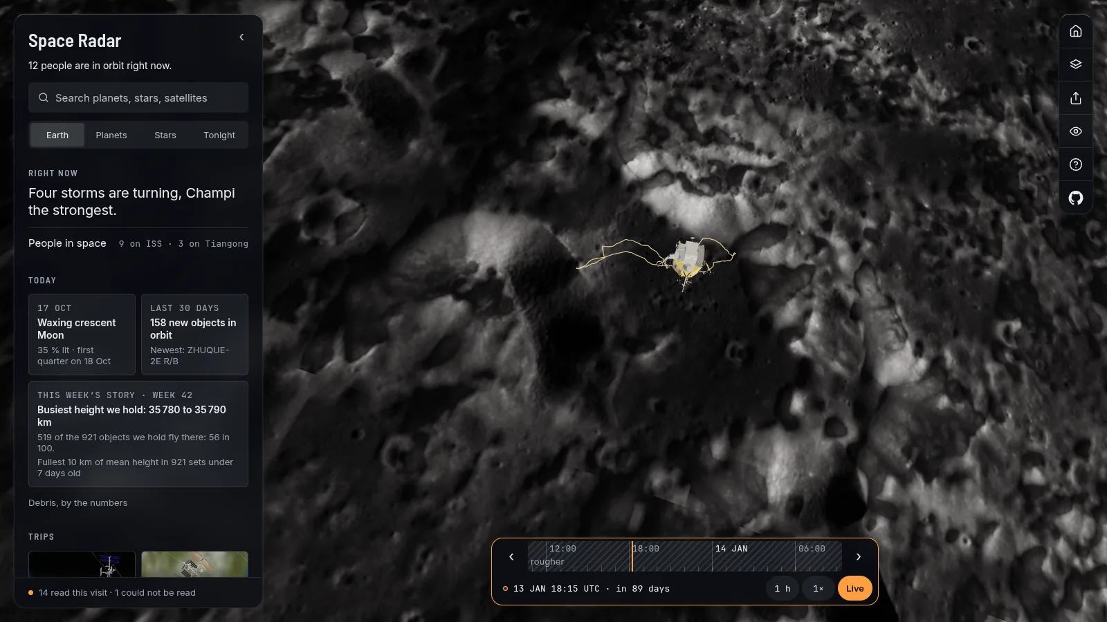
Two sites also carry the paths the astronauts and their rovers took. The Apollo 15 and 17 traverses are drawn as the Phil Stooke of the University of Western Ontario traced them, from tracks in LROC pictures and from the crews' own photographs and descriptions. Only paths with a documentary source are drawn; the others are left off rather than guessed.
The Sun, and a sunrise
Close up, the half that faces the Earth now wears the newest picture from NASA's Solar Dynamics Observatory, in the 171 angstrom channel, which shows gas near a million degrees. It is a browse picture, a small JPEG, and the card says so. It is dated and credited, and it turns with the Sun after it was taken. The far side, which no picture saw, is drawn in the same colours. The coronal loops are written but switched off in 1.2.0.
On the International Space Station, the light reddens at orbital sunrise: sunlight reddened by the air it grazes, from Rayleigh scattering only. That one is modelled and the card says so.
The giants' rings, as dark as they are
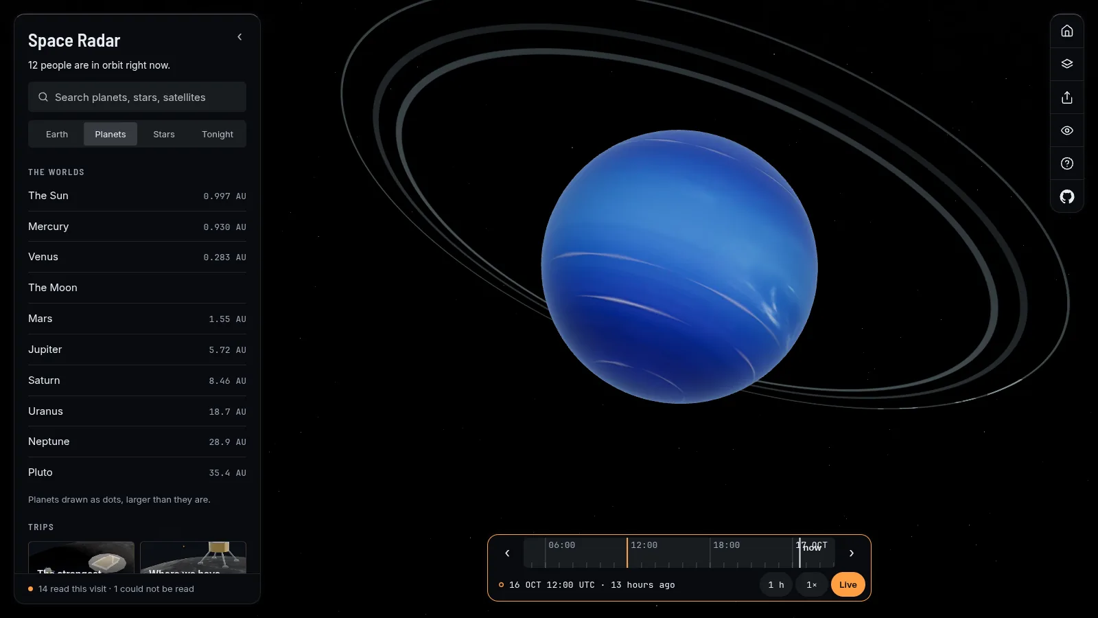
For years the rings of Uranus were drawn as pale grey, far brighter than they are. NASA's ring fact sheet gives their albedo as about 15 thousandths, against 0.488 for the planet. Space Radar now draws them at that darkness, a thirtieth of the clouds, so that in front of the planet they are dark threads. Their radii are measured; they are drawn ten times wider than they are, so that they can be seen at all, and the Deep exposure lifts them four times, as a long exposure does in Voyager's and Keck's pictures. Neptune's rings are beside them.
Jupiter's ring is fainter still: a halo and a main ring of dust, stopping a few millionths of the light. They are drawn from the distances and optical depths in NASA's fact sheet, and the two gossamer rings beyond are left out. Seen with the Sun behind them they show, as they did to Galileo and New Horizons; to show at all they are lifted, and the card says by how much. The Great Red Spot sits where the JUPOS team measured it, with the date on Jupiter's card.
Plumes, only where they were seen
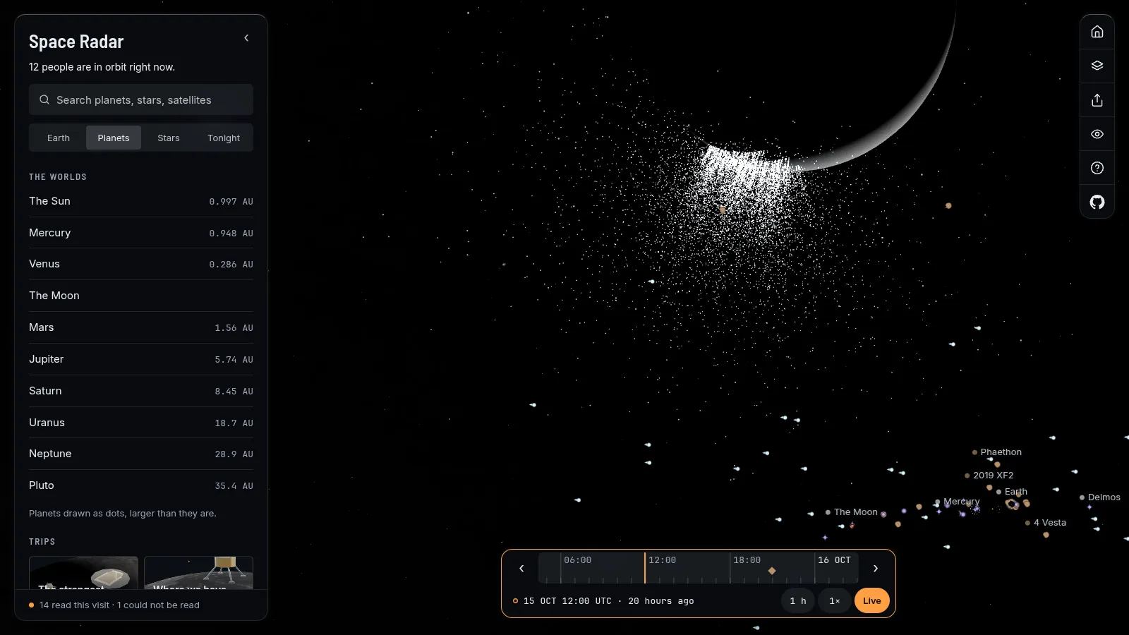
A plume is the most tempting thing to animate, so the rule here is strict: no plume without a dated observation. Each row in the registry names the craft, the date and the page that says so.
- Io: Pele's plume, 300 km high, was found by Voyager 1 in 1979. Tvashtar's, 330 km, was seen by New Horizons in March 2007, Prometheus's at 75 km and Pillan's at 140 km by Galileo in 1997. Five hot spots glow on the night side.
- Enceladus: the jets from the tiger stripes were imaged by Cassini from behind on 27 November 2005, and 101 of them were mapped by 2014.
- Triton: two dark geysers, Hili and Mahilani, seen by Voyager 2 in 1989, rising about 8 km with their clouds carried west for over 100 km.
Measured, modelled, illustrative
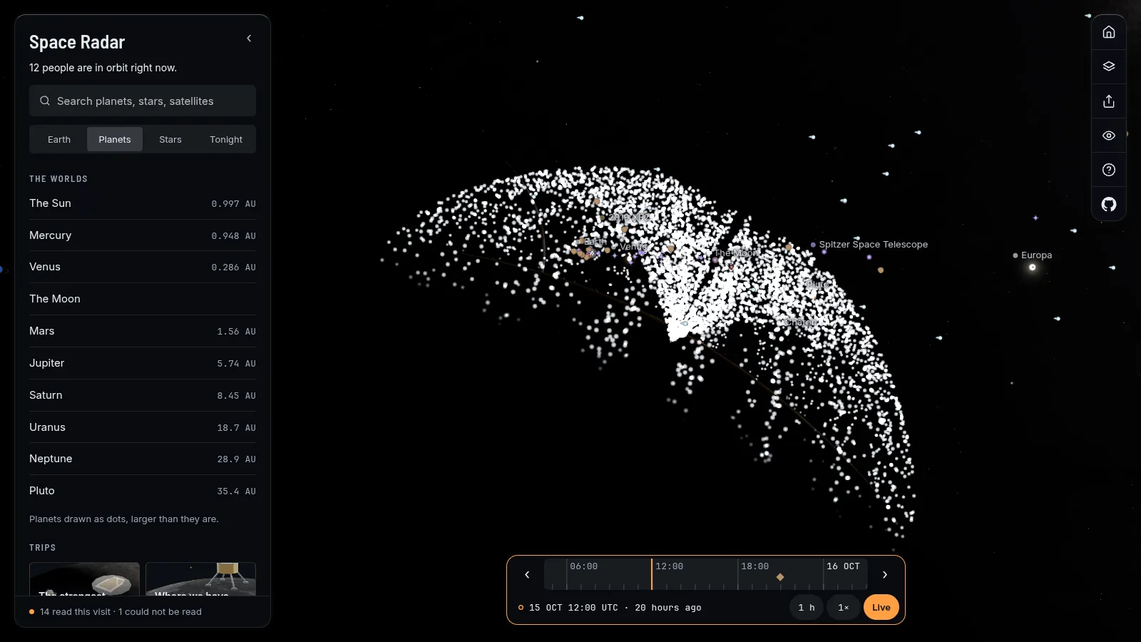
The places and heights are measured. The arcs the particles fly are modelled: a launch speed from the height, flat gravity bent round the moon, and the launch angles of its type. The four tiger stripes are drawn as straight segments, a reconstruction. The light is illustrative: stretched to be seen. A plume is drawn as it was seen, and may not be erupting now. Under reduced motion the particles are still.
Fly there
Pictures and sources
Screenshots of Space Radar (MIT licence). The Moon's heights are LOLA (NASA) and its traverses are Phil Stooke's through the NASA PDS Analyst's Notebook. Ring albedos are from NASA's fact sheets. The plume rows cite their pages, and the places are the IAU gazetteer's. Everything is listed in CREDITS.md.
More long reads
- Orion, the Ring and the nebulae you can fly into (release 1.2.0)
- Clusters you can fly into, and the edge of what we can see (release 1.2.0)
- Spacecraft that look like themselves (release 1.3.0)
- Galaxies, Carina and the Magellanic Cloud from their own numbers (release 1.3.0)
- All the long reads